Did you know that you can get real-time Weather information on Google Maps Android?
With the latest update, you can now access the local weather forecast, temperature, and air quality index right in the Google Maps app. Whether you’re planning a trip or simply curious about the weather, this feature is here to make your journey smoother.
Stay tuned to discover how to access weather information on Google Maps Android and the benefits of this exciting integration.
How to Access Weather Information on Google Maps Android
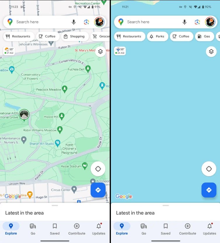
To access weather information on Google Maps for Android, open the app on your device. At the top left of the screen, below the search bar and location filters, you will find a small weather box. This box displays the local weather forecast, temperature, and air quality index.
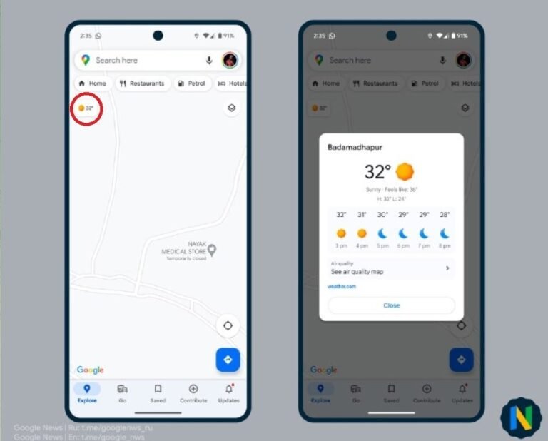
You can expand the box to view more detailed weather information and hourly temperature forecasts for the next 12 hours. The weather information is updated in real-time and will adjust if you change your location.
This feature allows you to check the weather in other areas, whether you are planning a trip or simply curious about the weather in different parts of the world.
Additionally, you can expand the air quality rating to see a color overlay on the map, indicating the air quality index. The scale ranges from green (low air pollution) to purple (high air pollution).
By tapping on the air quality rating, you can access more information about air quality and pollutants.
With this integration of weather information, Google Maps for Android provides users with easy access to up-to-date weather data while on the go.
Benefits of Weather Integration with Google Maps Android
The integration of weather information on Google Maps for Android offers several benefits for users. Firstly, it allows you to stay informed about the weather conditions in your current location, helping you plan your activities and avoid unfavorable weather. With the ability to access weather updates directly on Google Maps, you can easily check the temperature, precipitation, and other weather details before heading out.
Furthermore, the hourly temperature forecasts for the next 12 hours give you a better understanding of how the weather will change throughout the day. Whether you’re going for a hike, planning a picnic, or simply deciding what to wear, having accurate and up-to-date weather information at your fingertips can greatly enhance your daily routine.
In addition to weather updates, Google Maps for Android also provides valuable information about air pollution levels through the air quality overlay feature. By visualizing the air quality index on the map, you can make more informed decisions about where to go and how to protect your health. This integration of weather information and air quality data helps you navigate not only the physical aspects of your journeys but also the atmospheric conditions.
By leveraging the power of the Google Maps Weather API, Android users can enjoy a seamless and efficient experience, effortlessly integrating weather information into their daily lives. Whether you’re exploring a new city, planning a road trip, or simply staying informed about the current weather conditions, the integration of weather updates with Google Maps Android makes it easier than ever to make smart and well-informed decisions.
FAQ
Q: How do I access weather information on Google Maps for Android?
A: To access weather information on Google Maps for Android, simply open the app on your device. You will find a small weather box at the top left of the screen, below the search bar and location filters. This box displays the local weather forecast, temperature, and air quality index. You can expand the box to view more detailed weather information and hourly temperature forecasts for the next 12 hours.
Q: Can I check the weather in other areas using Google Maps for Android?
A: Yes, you can check the weather in other areas using Google Maps for Android. This feature allows you to not only check the local weather and air quality in your current location but also in other areas. It’s a convenient way to plan your trips and stay informed about weather conditions in different parts of the world.
Q: What does the air quality overlay on Google Maps for Android indicate?
A: The air quality overlay on Google Maps for Android displays a color scale from green to purple, indicating the air quality index from 1 to 10. Green represents low air pollution levels, while purple indicates high air pollution levels. By tapping on the air quality rating, you can access more information about air quality and pollutants.
Q: Which regions are covered by the air quality map on Google Maps for Android?
A: The air quality map on Google Maps for Android currently covers most of Europe, North America, Canada, Japan, South Korea, Cyprus, and Israel. It provides valuable information about air pollution levels in these regions, helping users make more informed decisions about where to go and how to protect their health.
Q: Is the weather information on Google Maps for Android updated in real-time?
A: Yes, the weather information on Google Maps for Android is updated in real-time. It adjusts if you change your location or if the weather conditions change. This ensures that you always have the most up-to-date weather data at your fingertips while using Google Maps on your Android device.
Q: What are the benefits of weather integration with Google Maps Android?
A: The integration of weather information on Google Maps for Android offers several benefits. Firstly, it allows you to stay informed about the weather conditions in your current location, helping you plan your activities and avoid unfavorable weather. The hourly temperature forecasts provide a better understanding of how the weather will change throughout the day. Additionally, the air quality overlay gives you valuable information about the air pollution levels in different areas, enabling you to make more informed decisions about where to go and how to protect your health.